Atlas AnatoliaAtlas Anatolia
Kültepe archaeological site

Kültepe

3000 BCE – 1500 BCEPhoto: Wikimedia Commons (CC BY-SA)
6

Interest

W 3KG 10
Bronze AgeHittiteAssyrianKayseri

Date Range

3000 BCE – 1500 BCE

Province

Kayseri

Ancient Name

Kanesh (Assyrian: Kārum Kanesh)

Location

Near modern Kayseri, Central Anatolia, Turkey

Primary Period

Early Bronze Age to Middle Bronze Age (c. 20th–18th centuries BCE)

Significance

Oldest known Assyrian trading colony (kārum) in Anatolia, source of the earliest written records (cuneiform tablets) in Anatolia, predating the Hittite Empire.

Kültepe matters as a transformative archaeological site that illuminates the dawn of Anatolia's written history and its integration into the Bronze Age world system.”

overview

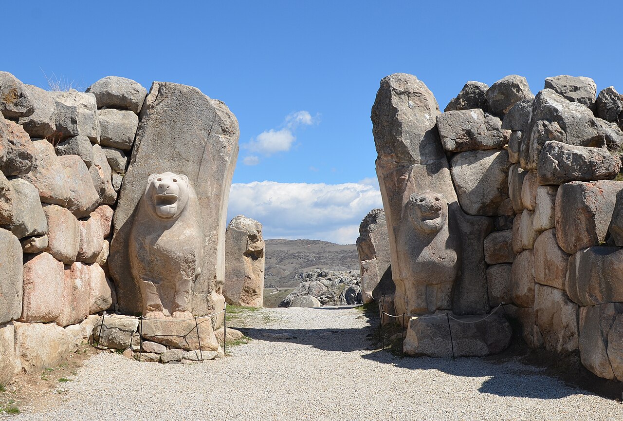
Located in central Anatolia, near modern Kayseri, the archaeological site of Kültepe presents as a large settlement mound (tepe) approximately 20 meters high, adjacent to a lower, extensive flat area. The mound itself represents the Bronze Age city of Kanesh, a fortified settlement with a palace, temples, and elite residences. The surrounding lower town, known as the *kārum*, was a distinct commercial district where merchants from the city of Assur in Mesopotamia established a thriving trading colony. This physical separation between the native Anatolian citadel and the foreign merchant quarter is a defining characteristic of the site, reflecting its unique socio-economic structure. Kültepe-Kanesh holds profound historical significance as the epicenter of the Old Assyrian trade network during the Middle Bronze Age (circa 20th–18th centuries BCE). It is the source of the earliest written records in Anatolia, predating the Hittite Empire by centuries. These records consist of over 23,000 cuneiform clay tablets found in the merchants' houses and archives of the *kārum*. Written in Old Assyrian, they are predominantly business documents—letters, contracts, and accounts—that meticulously detail the lucrative trade in Anatolian metals, especially copper and silver, exchanged for Mesopotamian tin and luxury textiles. This archive provides an unparalleled, detailed window into the earliest well-documented international trade system, including its legal frameworks, financial instruments, and the daily lives of the merchants and their families. Key structures excavated include the fortified palace complex on the citadel mound, which housed the local Anatolian ruler (*rubā’um*). In the lower *kārum*, the most revealing finds are the well-appointed private houses of Assyrian and local merchants. These multi-roomed residences typically contained family living quarters, storage rooms for goods, and dedicated archive rooms where tablets were stored in sealed containers. The architecture and artifacts demonstrate a blend of cultures, with Assyrian-style cylinder seals and Mesopotamian pottery found alongside distinctively Anatolian forms. The cultural context of Kültepe is one of sophisticated symbiosis. The Assyrian merchants lived under the legal and political authority of the king of Kanesh, operating their semi-autonomous *kārum* through a system of treaties and mutual economic benefit. This interaction facilitated not only immense material wealth but also a profound cultural exchange. The Assyrians introduced writing, the cylinder seal, and advanced metallurgical techniques to Anatolia, while also adopting elements of local customs. This period of intense contact laid crucial administrative, linguistic, and technological foundations that would later be absorbed and built upon by the rising Hittite Kingdom, which would eventually conquer Kanesh itself.

why_it_matters

Kültepe matters as a transformative archaeological site that illuminates the dawn of Anatolia's written history and its integration into the Bronze Age world system. The discovery of its *kārum*, or Assyrian merchant colony, and the associated cuneiform archives—the oldest in Anatolia—provide an unparalleled window into the complex economic, legal, and social interactions between Mesopotamian Assyrians and local Anatolians centuries before the Hittite Empire. These meticulously detailed business records and private letters offer a proto-globalized snapshot of long-distance trade, revealing sophisticated commercial networks, contractual law, and cultural exchange. For cultural heritage, Kültepe represents a foundational chapter in Anatolian identity, demonstrating that the region's historical significance extends far beyond later empires. The site physically anchors the narrative of early urbanization and international diplomacy, proving Anatolia was not a periphery but a vibrant core of economic innovation. Its archives, by giving voice to individual merchants and families, transform our understanding from abstract prehistory into documented human experience, making it a priceless touchstone for both scholarly research and public connection to a shared past.

evidence

Distinguishing what is well-established from what remains debated.

confirmed

2
  • Over 23,000 cuneiform clay tablets (Old Assyrian dialect) detailing commercial transactions, contracts, loans, and private letters, confirming a vast Assyrian merchant network.
  • Archaeological remains of distinct architectural zones: a fortified höyük (citadel/palace) and an extensive lower city (kārum) with houses, workshops, and archives.

inferred

1
  • The political structure of Kanesh as a local Anatolian kingdom subservient to the Assyrian trading network's economic demands, inferred from treaty texts and administrative records.

debated

1
  • The exact causes of the destruction and abandonment of the kārum level II (c. 1836 BCE), with theories ranging from local rebellion, fire, to conflict with emerging Hittite power.

excavation

1925

Initial Systematic Excavations

Led by Bedřich Hrozný

First major excavations led by Bedřich Hrozný, who identified the site as ancient Kanesh and discovered the first cuneiform tablets linking it to Assyrian trade.

1948

Resumption and Long-term Project

Led by Tahsin Özgüç and Nimet Özgüç

Excavations resumed under Turkish leadership, focusing on both the kārum (lower city/merchant quarter) and the höyük (mound/royal citadel). This began a continuous archaeological project.

2006

Ongoing International Investigations

Led by Fikri Kulakoğlu (Ankara University)

Current multidisciplinary excavations and research, including extensive work on the lower town, revealing thousands of additional tablets and detailed insights into domestic and commercial architecture.

location

Related Sites

sources

  • Wikipedia — KültepeLink

Research Papers

Stay in the loop

Get notified when we add new sites or major features. We send at most 1–2 emails per year. We never sell your email.

Atlas AnatoliaAtlas Anatolia

An interactive atlas of ancient Anatolian sites. Explore civilizations, monuments, and stories across millennia.

info@atlasanatolia.com

© 2026 Atlas Anatolia. Content is provided for educational purposes.

Map data © OpenStreetMap contributors