Overview
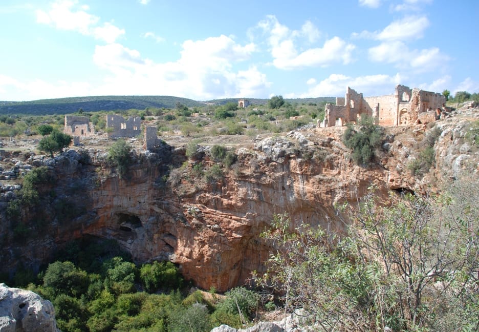
Kanlidivane — ancient Canytelis — is one of the most visually dramatic archaeological sites in Turkey, built around an enormous natural sinkhole (obruk) approximately 60 meters deep and 200 meters across. The ancient inhabitants carved tombs, reliefs, and inscriptions directly into the vertical walls of the chasm, while churches and towers were built along its rim.
The site lies in the Rough Cilicia (Cilicia Tracheia) region of Mersin province, a landscape of limestone karst where sinkholes are common geological features. The name "Kanlidivane" — "bloody madhouse" in Turkish — derives from local legends about the chasm, though the ancient name Canytelis suggests a more prosaic origin.
"The city of Canytelis is situated on a very high rock; it is round and hollow inside like a theatre."
— Strabo, Geographica (c. 20 BC - 23 AD)
Rock-cut reliefs on the chasm walls include a remarkable family scene with six figures, considered one of the finest Roman-period rock reliefs in Cilicia. Multiple early Christian churches dating from the 4th-6th centuries CE crown the edges of the sinkhole, including a large basilica. A defensive tower — possibly Hellenistic in origin — guards the northern approach.
The surrounding area preserves an extensive ancient settlement with cisterns, olive presses, and agricultural installations that reveal the economic life of this small but prosperous community. The landscape of ancient Rough Cilicia, dotted with dozens of similar small settlements, was a major olive oil producing region in antiquity.

Kanlidivane sinkhole | U.S. Air Force photo by Senior Airman Daniel Phelps/Released (Public domain)
The architectural remains, including substantial cisterns and the foundations of domestic structures scattered on the plateau, point to a self-sufficient community. The presence of imported fine wares, though limited, indicates trade connections with coastal cities like Elaiussa Sebaste and Corycus, likely exchanging olive oil for other goods. The site's decline appears gradual, beginning in the 7th century CE, coinciding with Arab raids along the Cilician coast and a general shift of population to more defensible locations. While some ecclesiastical activity may have persisted, Kanlidivane was largely abandoned by the early medieval period, its dramatic chasm becoming a silent necropolis.