Overview
Karatepe-Aslantas is a Neo-Hittite fortified palace on the Ceyhan River in the Taurus foothills of Osmaniye Province. Built in the late 8th century BCE by King Azatiwata of the Danunians, it guards the strategic pass connecting Cilicia to the Anatolian interior.
The site's world importance lies in its bilingual inscription — a lengthy text carved in both Phoenician script and Hieroglyphic Luwian (the script of the late Hittite successor states). Discovered in 1946 by Helmuth Bossert, this inscription was the key that unlocked the decipherment of Hieroglyphic Luwian, much as the Rosetta Stone enabled the decipherment of Egyptian hieroglyphs. The inscription records Azatiwata's achievements in building the city, securing peace, and establishing prosperity for his people.
"I built this fortress and gave it the name Azatiwataya. May the Storm God and the gods of Azatiwataya protect it."
— Azatiwada (King of Adanawa), Karatepe bilingual inscription, c. 8th century BCE
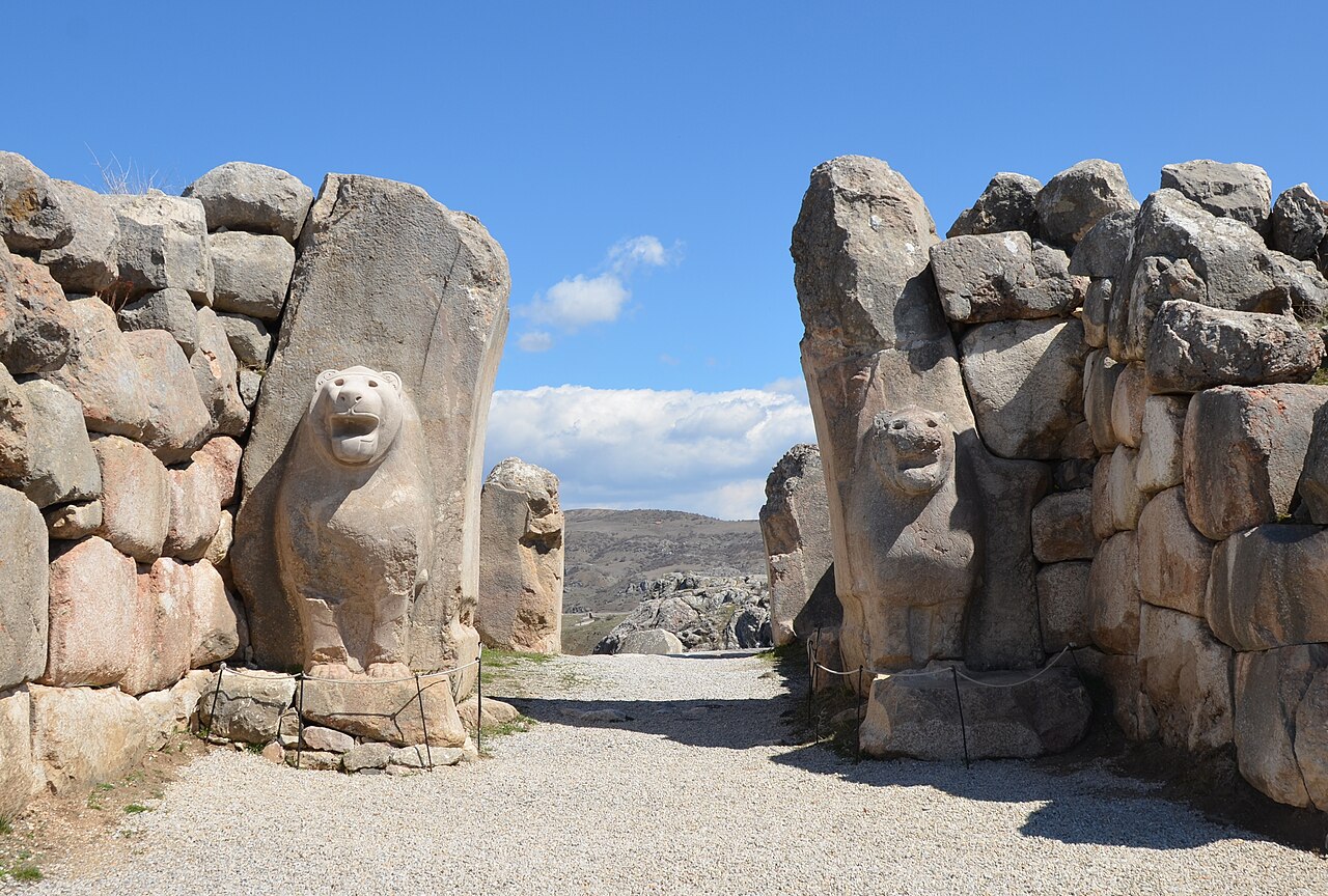
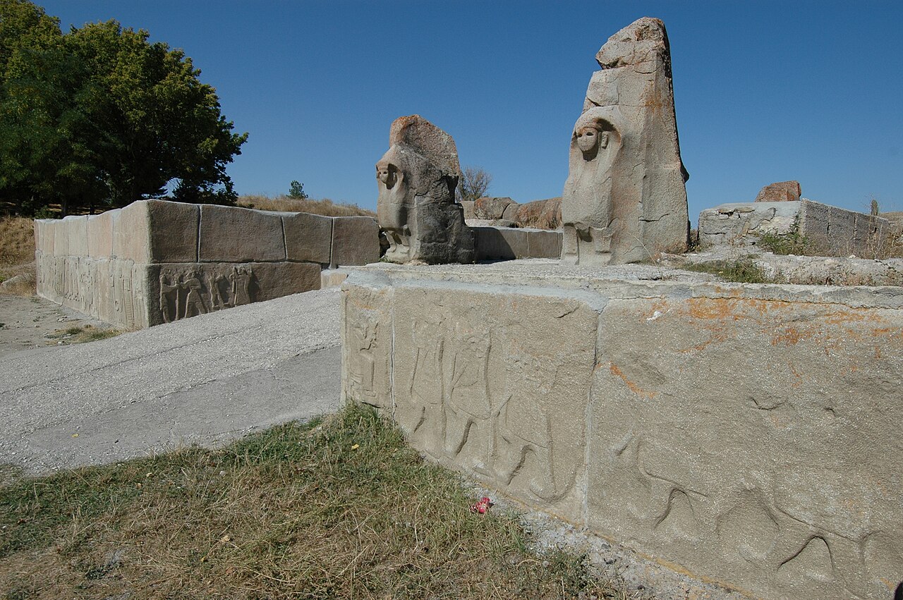
The fortress gates are flanked by monumental stone reliefs and sculptures featuring lions, sphinxes, warriors, banquet scenes, and mythological figures in a distinctive Neo-Hittite style that blends Hittite, Phoenician, and Aramaean artistic traditions. The reliefs are displayed in situ in an open-air museum established in 1960, one of Turkey's first.
The site provides exceptional evidence for the political organization of the Neo-Hittite kingdoms that emerged after the collapse of the Hittite Empire around 1180 BCE, bridging the gap between Bronze Age Anatolia and the Iron Age.

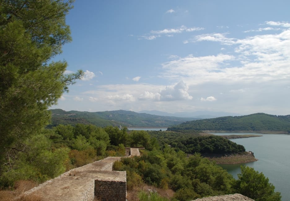
Karatepe-Aslantaş National Park with the trees | Nur Çağlar (CC BY-SA 4.0)
The fortress architecture is a hallmark of Neo-Hittite military engineering. Its massive walls, constructed with large, roughly dressed stones (cyclopean masonry), were punctuated by fortified gates. The most famous are the South and North Gates, flanked by monumental basalt and limestone orthostats carved with intricate reliefs. These depict not only mythological guardians like sphinxes and lions but also vivid scenes of royal feasting, hunting, and processions, offering a glimpse into courtly life and state propaganda.
Archaeological finds within the citadel, including pottery, metal tools, and loom weights, suggest a thriving community engaged in agriculture, animal husbandry, and craft production. The site's strategic position allowed it to control the movement of goods, likely including metals from the Taurus Mountains and timber from the Amanus range, linking the Anatolian plateau to the Mediterranean Sea. The fortress appears to have been destroyed by fire, possibly during the campaigns of the Assyrian king Esarhaddon or his successor Ashurbanipal in the early 7th century BCE, leading to its abandonment and subsequent preservation beneath the soil.