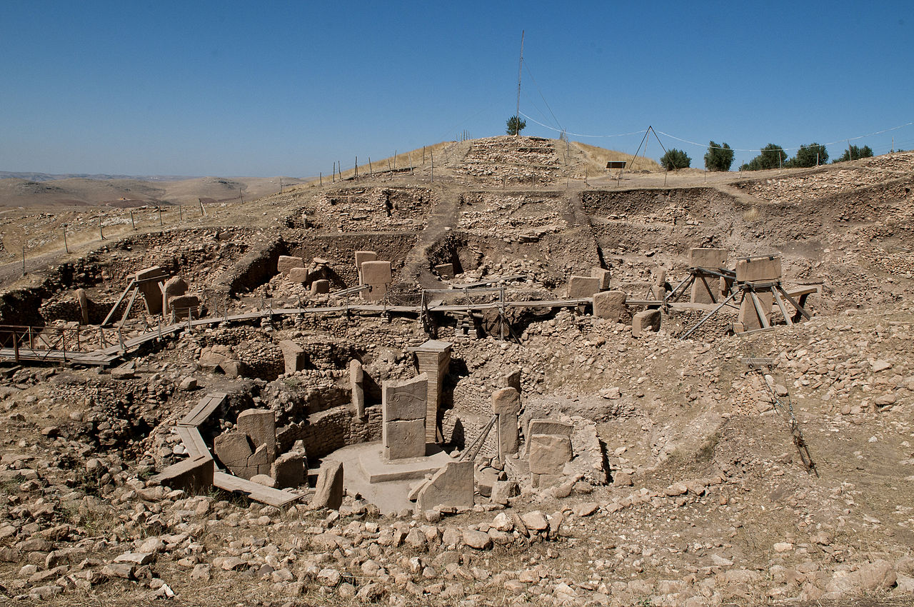
Atlas AnatoliaAtlas Anatolia
Colossal stone heads at the East Terrace of Mount Nemrut

Nemrut Dağ

Nemrut Dağı69 BCE – 34 BCE
5

Interest

W 9K
HellenisticCommageneAdıyaman

Elevation

2,134 m

Statue Height

8–10 m (seated)

UNESCO Status

World Heritage Site (1987)

Builder

Antiochus I of Commagene

Construction Period

c. 62-34 BCE

Number of Colossal Statues

10 (5 on each terrace)

Nemrut Dağ is one of the most visually dramatic archaeological sites in the world.”

WFrom Wikipedia

Mount Nemrut is a 2,134-metre-high mountain in southeastern Turkey, notable for the summit where a number of large statues are erected around what is assumed to be a royal tomb from the 1st century BC. It is one of the highest peaks in the eastern Taurus Mountains.

Read full article on Wikipedia

Overview

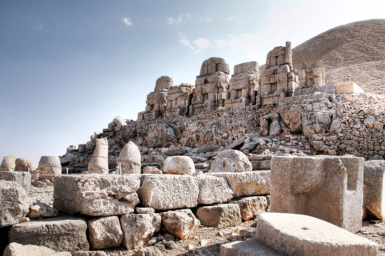
Nemrut Dağ is located in Adıyaman Province in southeastern Türkiye. At its summit (2,134 meters), King Antiochus I Theos of the Kingdom of Commagene (c. 69–34 BCE) built an elaborate funerary sanctuary combining Persian and Greek religious elements.

The site consists of a tumulus (artificial mound) of crushed rock, approximately 50 meters high and 150 meters in diameter, flanked by terraces on the east and west sides. Each terrace features a row of colossal seated figures, approximately 8–10 meters high, representing Antiochus himself alongside a syncretistic pantheon that includes Zeus-Oromasdes, Apollo-Mithras-Helios-Hermes, Artagnes-Heracles-Ares, and the goddess Commagene.

"I, the great king Antiochus, have had this sanctuary founded as proof of my devotion to the gods and my reverence for their divine power."
— Antiochus I of Commagene, Nomos Inscription, c. 70 BCE

The heads of these statues have toppled from their bodies over centuries due to earthquakes and weathering, creating the iconic scene of massive stone heads resting on the ground, facing the rising or setting sun.

The site is particularly famous for the dramatic effect of sunrise and sunset, when the colossal heads are illuminated against the mountain landscape.

APOLLON NEMRUT MOUNTAIN

APOLLON NEMRUT MOUNTAIN | Mkrc85 (CC BY-SA 4.0)

The architectural program is meticulously ordered. The East and West Terraces each host a row of five colossal seated statues representing syncretic deities: Zeus-Oromasdes, Apollo-Mithras-Helios-Hermes, and Artagnes-Heracles-Ares, flanked by statues of King Antiochus I and a deified eagle and lion. Behind these figures stand rows of finely carved relief stelae (dexiosis scenes) depicting Antiochus shaking hands with various gods, symbolizing his divine affinity. The entire complex was a hierothesion, a sacred burial site for the royal cult, maintained by a priesthood whose living quarters and economic support likely came from the fertile lands in the Kahta valley below.

Despite its grandeur, the sanctuary had a short active life, closely tied to the reign of Antiochus I. Following the kingdom's annexation by Rome in 72 CE, the site was abandoned. The colossal heads were deliberately toppled, likely by iconoclasts in the late Roman or early Christian period, severing the statues from their bodies. Its remote location preserved it from systematic plundering, but also led to its obscurity until its modern rediscovery. The monument stands as a testament to a brief, brilliant moment of cultural synthesis before the political realities of the Roman Empire reshaped the region.

Why It Matters

Nemrut Dağ is one of the most visually dramatic archaeological sites in the world. It represents the unique cultural fusion of the Commagene Kingdom — a small but ambitious state that blended Greek and Persian traditions into a distinctive royal cult. The colossal statuary demonstrates the creative synthesis possible at the crossroads of civilizations. The site was inscribed as a UNESCO World Heritage Site in 1987.

Stay curious

New stories and sites, once a month. No spam.

Evidence & Interpretation

Distinguishing what is well-established from what remains debated.

Well-Established Facts

4
  • Inscriptions at the site identify the builder as King Antiochus I of Commagene.
  • The pantheon depicted combines Greek and Persian deities in syncretic pairings.
  • The tumulus is an artificial mound of crushed limestone, approximately 50 m high.
  • The site's extensive cult inscription, the Nomos, is carved on the backs of the colossal statues and on stelae, detailing the religious and legal ordinances of the royal cult.

Scholarly Inferences

1
  • The tumulus likely contains the burial chamber of Antiochus I, though it has never been found.

Debated Interpretations

1
  • Whether the burial chamber exists within the tumulus or was placed elsewhere remains unresolved.

Discovery & Excavation

1881

Rediscovery

Led by Karl Sester

German engineer Karl Sester reported the site to scholars.

1882

First investigation

Led by Puchstein & Humann

Otto Puchstein and Karl Humann made the first detailed study and drawings.

1953

American expedition

Led by Theresa Goell

Theresa Goell conducted extensive excavations and documentation.

2001

Geophysical Survey of Tumulus

Led by German Archaeological Institute (DAI) and University of Karlsruhe

A comprehensive geophysical survey using ground-penetrating radar and seismic methods was conducted to locate the burial chamber without excavation.

More Photos

Museum Artifacts

Community Photos

Share your experience

Have you visited this site? Upload your photos to help others discover it.

Location

Related Sites

Read the full article on World History Encyclopedia
World History Encyclopedia · CC BY-NC-SA

Sources

  • Nemrud Dagi: The Hierothesion of Antiochus I of CommageneDonald H. Sanders (1996)
  • UNESCO World Heritage — Nemrut DağLink

Research Papers

Stay in the loop

Get notified when we add new sites or major features. We send at most 1–2 emails per year. We never sell your email.

Atlas AnatoliaAtlas Anatolia

An interactive atlas of ancient Anatolian sites. Explore civilizations, monuments, and stories across millennia.

info@atlasanatolia.com

© 2026 Atlas Anatolia. Content is provided for educational purposes.

Map data © OpenStreetMap contributors