Atlas AnatoliaAtlas Anatolia
The reconstructed Antonine Nymphaeum at Sagalassos with mountains behind

Sagalassos

500 BCE – 700 CE
2

Interest

W 3K
ClassicalHellenisticRomanByzantineGreekRomanByzantineBurdur

Altitude

1,450-1,700 meters

Key Monument

Antonine Nymphaeum (reconstructed)

Bath Cold Pool

1,300 m²

Excavation Since

1990 (Belgian team)

Theatre Capacity

Approximately 9,000 spectators, one of the largest in Pisidia.

Major Earthquake

Final destruction by a major earthquake circa 590-620 CE, confirmed by coin hoards and destruction layers.

Sagalassos offers an unmatched opportunity to study a Roman provincial city in its entirety.”

WFrom Wikipedia

Sagalassos is an archaeological site in southwestern Turkey, one of the best-preserved ancient cities in the Mediterranean, known for its monumental fountain and Roman-era urban remains.

Read full article on Wikipedia

Overview

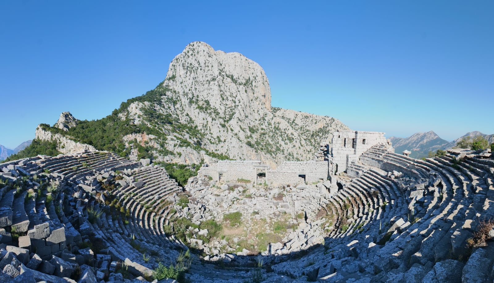
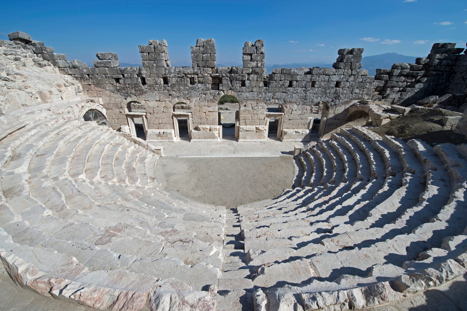
Sagalassos is a revelation. Perched at 1,500 meters on the slopes of the Taurus Mountains in Burdur Province, this Roman city is arguably the best-preserved ancient urban center in Turkey — and among the best in the entire eastern Mediterranean. Its altitude and remoteness protected it from the stone-robbing that diminished so many lowland cities.

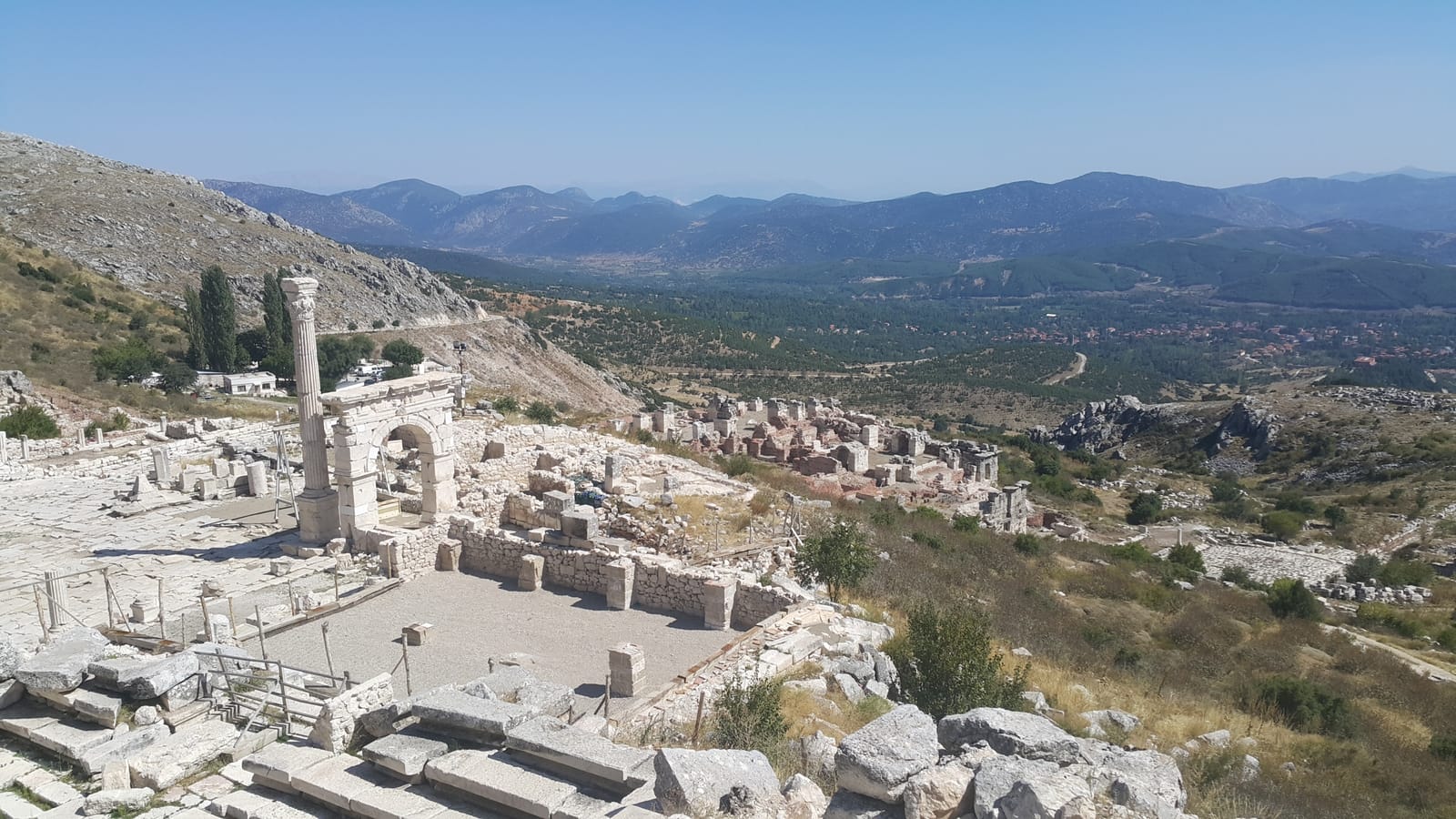
The Antonine Nymphaeum, a monumental fountain dedicated during the reign of Marcus Aurelius, has been spectacularly reconstructed. Standing over 9 meters tall with flowing water once again cascading through its niches, it is one of the most impressive Roman fountain restorations anywhere. The Upper Agora, flanked by the Bouleuterion and a heroon, provides a complete picture of Roman civic architecture.

"The Pisidians, a warlike people, inhabit the highlands, and among them is Sagalassos, a city of great strength and elevation."
— Strabo, c. 7 BCE - 23 CE

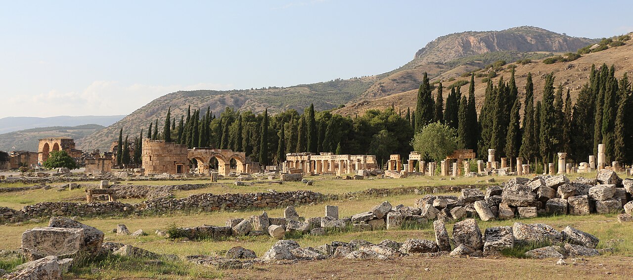
The Roman baths of Sagalassos were among the largest in Asia Minor, with a cold pool that measured 1,300 square meters — larger than many modern Olympic swimming pools. The library, macellum (market hall), and colonnaded streets complete the urban fabric.

Sagalassos was destroyed by a series of earthquakes in the 7th century CE and abandoned, leaving the remains largely undisturbed. Belgian-led excavations since 1990 have made it one of the most meticulously documented archaeological sites in the Mediterranean, combining traditional archaeology with environmental science, ceramics analysis, and digital reconstruction.

Sagalassos Antik Kenti 03

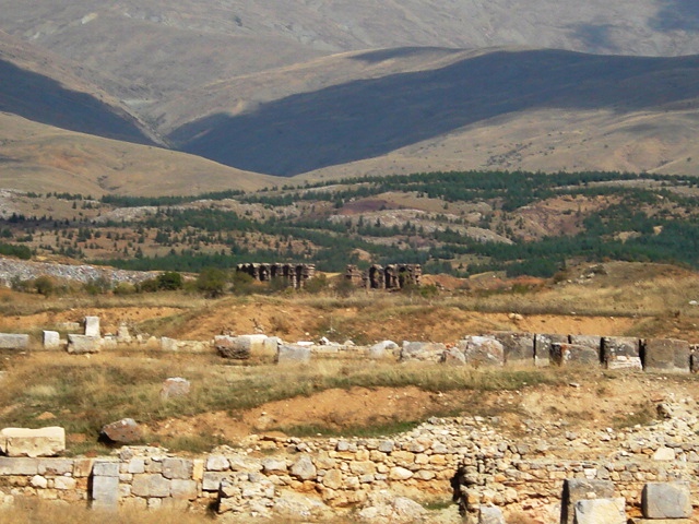
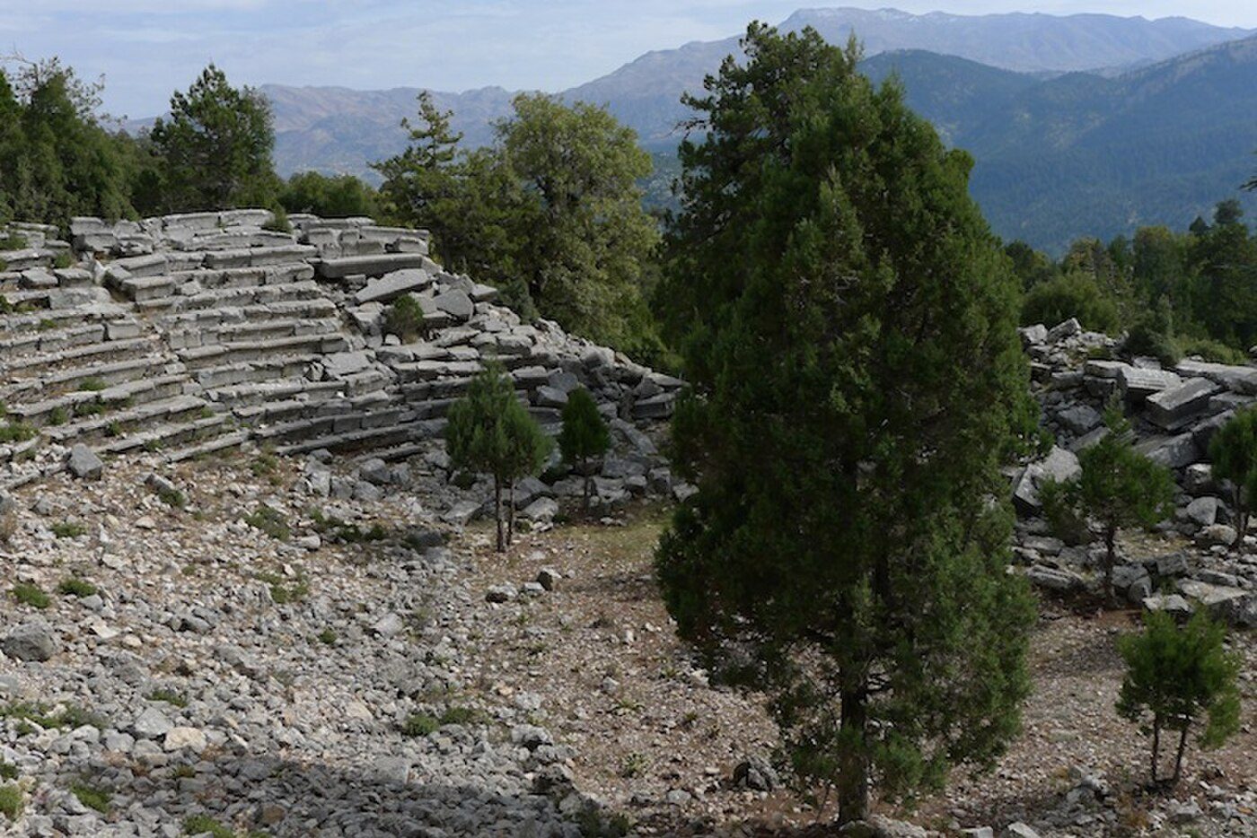
Sagalassos Antik Kenti 03 | BerkhanTr (CC BY-SA 4.0)

The city's urban fabric reveals a sophisticated infrastructure, including a complex aqueduct system that channeled water from mountain springs into the city's fountains, baths, and public latrines. The Upper Agora, framed by a Doric portico and a bouleuterion (council house), was the civic heart. Daily life centered on the production of its famous Red Slip Ware pottery, with industrial kiln complexes operating for centuries. Sagalassos was a key node in regional trade, exporting its pottery and importing goods like Egyptian glass and Italian wine amphorae. Its decline was a protracted process. Following the devastating 7th-century CE earthquakes, the urban core was largely abandoned. A small, fortified settlement persisted on the site into the 13th century, evidenced by Byzantine glazed pottery and a chapel built into the ruins of the Temple of Apollo Klarios.

Why It Matters

Sagalassos offers an unmatched opportunity to study a Roman provincial city in its entirety. Because it was abandoned after earthquake destruction and never substantially rebuilt or robbed, the archaeological record is exceptionally complete — from monumental public buildings to everyday workshops and homes. The Belgian excavation project, led by Marc Waelkens for over three decades, has set new standards for interdisciplinary archaeological research, combining excavation with archaeobotany, archaeozoology, geomorphology, and digital modeling. Sagalassos is a benchmark for how modern archaeology should be conducted.

Stay curious

New stories and sites, once a month. No spam.

Evidence & Interpretation

Distinguishing what is well-established from what remains debated.

Well-Established Facts

4
  • The Antonine Nymphaeum was dedicated during the reign of Marcus Aurelius (161-180 CE) based on inscriptions found in situ.
  • A series of earthquakes in the 7th century CE destroyed the city, as evidenced by collapsed structures and seismic damage patterns.
  • Sagalassos was a major producer of tableware pottery (Sagalassos Red Slip Ware) distributed across the eastern Mediterranean from the 1st to 7th centuries CE.
  • Environmental analysis reveals that the surrounding area was heavily deforested during the Roman period for construction and fuel.

Scholarly Inferences

1
  • The city's prosperity under Rome was partly driven by its position on trade routes connecting the Mediterranean coast with the Anatolian interior.

Debated Interpretations

1
  • Whether Alexander the Great personally besieged Sagalassos in 333 BCE or bypassed it is debated, though Arrian's account suggests direct engagement.

Discovery & Excavation

1706

First European visit

French traveler Paul Lucas was the first European to describe the ruins of Sagalassos.

1824

Identification by Arundell

Reverend Francis Arundell correctly identified the ruins as ancient Sagalassos.

1990

Belgian excavations begin

Led by Marc Waelkens

Marc Waelkens of KU Leuven began the long-term interdisciplinary excavation project.

2008

Nymphaeum reconstruction

The Antonine Nymphaeum was reconstructed and water flowed through it once again.

2010–2020

Ongoing interdisciplinary research

Continued excavation combined with archaeobotany, ceramics studies, and digital 3D modeling.

More Photos

Museum Artifacts

Community Photos

Share your experience

Have you visited this site? Upload your photos to help others discover it.

Location

Related Sites

Read the full article on World History Encyclopedia
World History Encyclopedia · CC BY-NC-SA

Sources

  • Sagalassos: City of DreamsMarc Waelkens & Jeroen Poblome (2011)
  • Sagalassos Archaeological Research ProjectLink
  • Roman Provincial Urbanism in the Eastern MediterraneanHugh Elton (2005)

Research Papers

Stay in the loop

Get notified when we add new sites or major features. We send at most 1–2 emails per year. We never sell your email.

Atlas AnatoliaAtlas Anatolia

An interactive atlas of ancient Anatolian sites. Explore civilizations, monuments, and stories across millennia.

info@atlasanatolia.com

© 2026 Atlas Anatolia. Content is provided for educational purposes.

Map data © OpenStreetMap contributors