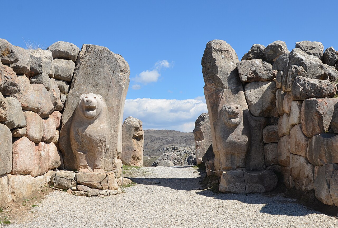
Sometime around 1200 BCE, the ancient world fell apart. The Hittite Empire, which had controlled most of Anatolia and challenged Egypt at the Battle of Kadesh, vanished so completely that its existence was forgotten for three thousand years. Mycenaean Greece collapsed. The great trading cities of the Levantine coast burned. Egypt survived but never recovered its former reach. Scholars call it the Bronze Age Collapse, and it remains one of the great unsolved puzzles of ancient history.
The causes are still debated: drought, earthquakes, disrupted trade networks, internal revolts, the mysterious Sea Peoples who appear in Egyptian records raiding coastlines they could not defend. Most likely it was all of these at once, a cascade of failures that no single kingdom could withstand. What is not debated is the scale of the catastrophe. Within a few decades, the international system that had connected Egypt, Mesopotamia, Anatolia, and Greece for centuries ceased to function. Writing disappeared from much of the region. Cities emptied. The lights went out.
The Dark Age That Wasn't
In Anatolia, the period between roughly 1200 and 900 BCE used to be called a Dark Age. The term has fallen out of favor, partly because it suggests nothing was happening, and partly because archaeology keeps finding things that prove otherwise.
What happened in Anatolia after the Collapse was not emptiness but fragmentation. The vast Hittite Empire, governed from Hattusha in central Anatolia, broke into dozens of small kingdoms, each preserving pieces of Hittite culture while developing in new directions. These Neo-Hittite states, clustered in southeastern Turkey and northern Syria, are some of the most fascinating and least-known political entities of the ancient world.
Karatepe-Aslantas, a fortress in the Taurus mountains, preserves one of their most important monuments: a bilingual inscription in Phoenician and Hieroglyphic Luwian that helped scholars decipher the Luwian script. It was the Rosetta Stone of Anatolian archaeology. The reliefs at Karatepe show a world in transition: Hittite artistic traditions mixing with Phoenician and Aramean influences, creating something that belongs to none of them entirely.
The Phrygians: A New Center of Gravity
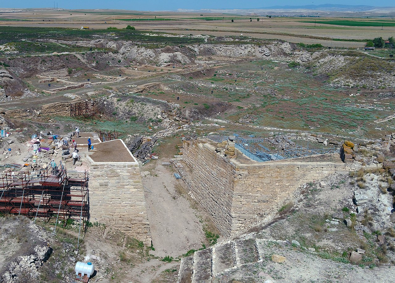
While the Neo-Hittite kingdoms held the southeast, a new power was forming in central Anatolia. The Phrygians, who may have migrated from the Balkans during the upheavals of the Collapse, established their capital at Gordion, on the Sakarya River about a hundred kilometers southwest of modern Ankara.
Gordion in the eighth century BCE was a wealthy, sophisticated city. Excavations led by the University of Pennsylvania revealed a citadel with massive megaron-style buildings, elaborate wooden furniture preserved in the dry soil, and a material culture that drew on both Anatolian and Aegean traditions. The Phrygians were skilled metalworkers, weavers, and musicians. The Greeks credited them with inventing several musical modes and the double flute.
The great tumulus at Gordion, excavated in 1957, is one of the most remarkable burial mounds ever opened. Inside, archaeologists found the body of a man in his sixties, surrounded by the remains of an enormous funeral feast: 157 bronze vessels, wooden serving tables inlaid with geometric patterns, and residue that chemical analysis later identified as a mixed drink of wine, barley beer, and mead. The tomb is traditionally associated with King Midas, the figure Greek mythology remembered as the man whose touch turned everything to gold. The real Midas was a historical king, mentioned in Assyrian records, who ruled Phrygia in the late eighth century. He did not have a golden touch, but he was rich enough that the legend makes a certain kind of sense.
The Lydians: Inventors of Money
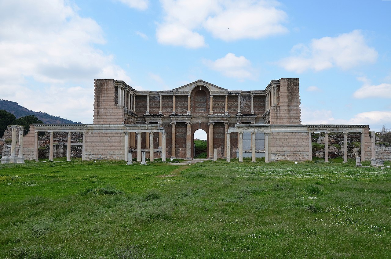
West of the Phrygians, in the fertile valleys draining into the Aegean, the Lydians were building something equally remarkable. Their capital, Sardis, sat at the foot of Mount Tmolus where the Pactolus River, famously gold-bearing, flowed through the city center.
The Lydians are credited with one of the most consequential inventions in human history: coinage. Sometime in the early seventh century BCE, Lydian craftsmen began stamping small lumps of electrum, a naturally occurring gold-silver alloy, with official marks guaranteeing their weight and purity. The idea spread east to Persia and west to Greece with remarkable speed. Within a century, coined money had transformed trade across the Mediterranean. King Croesus of Lydia, who refined the system by introducing separate gold and silver coins, became a byword for wealth that survives in the English expression "rich as Croesus."
The Lydians were culturally adventurous in other ways. Herodotus, who wrote extensively about them, reported that they invented dice games, ball games, and various forms of entertainment to distract themselves during a prolonged famine. They were among the first peoples in Anatolia to adopt Greek cultural practices while maintaining their own language and traditions. Sardis became a genuinely cosmopolitan city, home to Greeks, Persians, Jews, and Lydians who seem to have coexisted with relatively little friction.
Connections and Collisions
What makes the Iron Age in Anatolia so interesting is the density of interaction. The Neo-Hittite kingdoms in the southeast were in constant contact with Assyria and the Aramean states of Syria. The Phrygians traded with both the Neo-Hittites and the Greek colonies springing up along the Aegean coast. The Lydians served as intermediaries between the Greek and Persian worlds. Anatolia in the early first millennium BCE was not isolated or backward. It was a crossroads where ideas, goods, and technologies from three continents mixed and mutated.
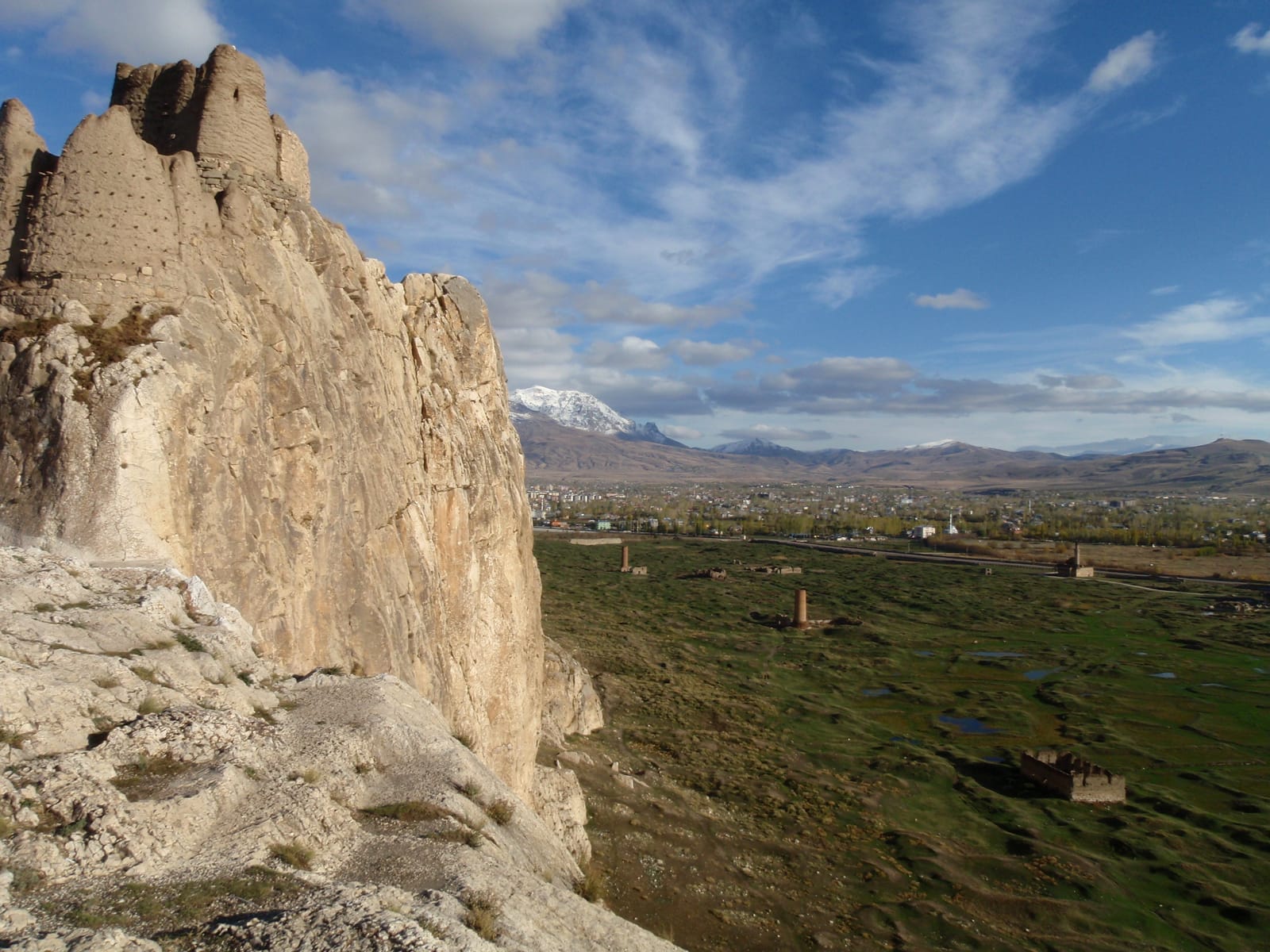
The Urartian kingdom around Lake Van, in eastern Turkey, adds another layer. The Urartians were master hydraulic engineers, building irrigation canals and fortress cities that rivaled anything in Mesopotamia. Their capital at Tushpa, the rock citadel above Lake Van, controlled a territory that stretched from northwestern Iran to the headwaters of the Euphrates. When they fell to the Medes and Scythians in the sixth century, they left behind a landscape of fortresses, inscriptions, and canals that modern Turkish farmers still use.
The Persian Takeover and What Survived
Cyrus the Great conquered Lydia in 547 BCE, and within a few decades the entire Anatolian peninsula was part of the Achaemenid Persian Empire. The local kingdoms vanished as independent political entities. But the cultures that created them did not disappear. Phrygian language and religion persisted for centuries under Persian and later Hellenistic rule. Lydian metalworking traditions influenced Greek and Persian craftsmanship. Neo-Hittite artistic conventions can be traced in later Anatolian art.
The Iron Age taught Anatolia something that the Bronze Age empires, with their centralized power and elaborate bureaucracies, had not: that small, flexible, culturally hybrid states could be extraordinarily creative. The Phrygians, Lydians, Neo-Hittites, and Urartians were never as powerful as the Hittite Empire that preceded them or the Persian Empire that followed. But they invented coinage, cracked ancient scripts, created distinctive artistic traditions, and built cities that impressed the Greeks. They made the most of a broken world.