# Underwater Secrets: Kekova's Sunken Lycian City
A Landscape Submerged
"The coasts of Lycia are full of ancient cities, many of which have sunk beneath the waves."
Captain Francis Beaufort, Karamania (1817)
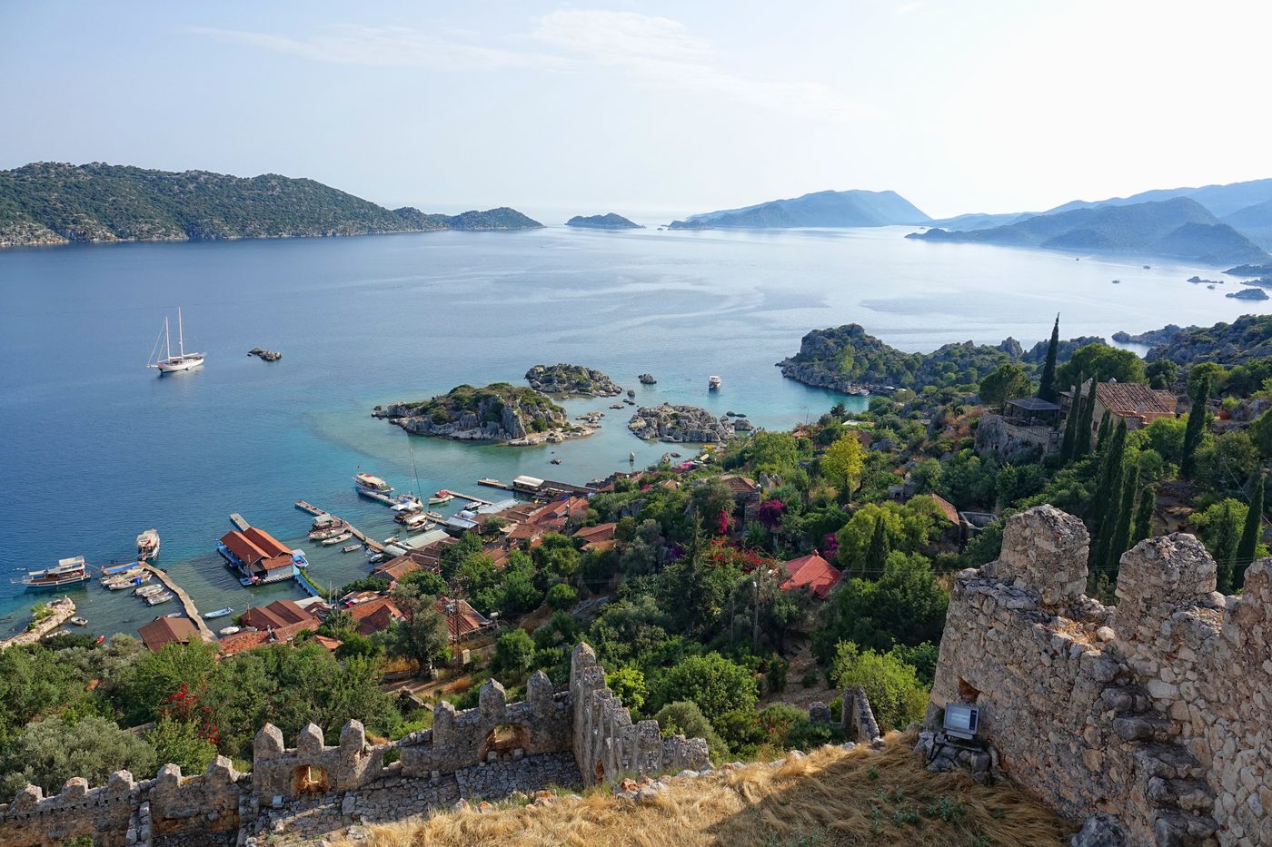
The turquoise waters of the Mediterranean off the coast of modern-day Antalya are deceptively tranquil. To the casual eye, they offer a pristine vista of sun, sea, and scattered islands. But glide over the surface of Kekova Sound in a clear-bottomed kayak or peer through a diver’s mask, and the true story emerges. Below, the orderly lines of ancient walls, the outlines of staircases descending into the blue abyss, and the haunting forms of stone sarcophagi tell a tale of a world lost. This is not a myth like Atlantis, but a tangible, historical reality: the sunken city of Dolichiste, part of the ancient Lycian region, a civilization that thrived here for millennia before the sea claimed a portion of its legacy.
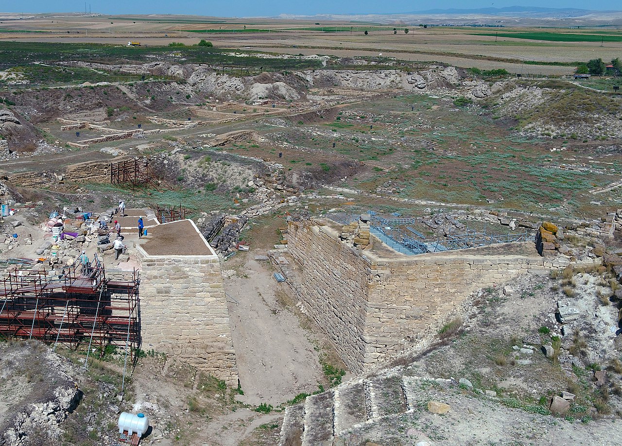
The Lycians were a proud, enigmatic people, mentioned in Hittite texts as the "Lukka" and in Homer’s Iliad as allies of Troy. They inhabited the rugged terrain of the Teke Peninsula, a land of formidable mountains and dramatic coastline. Unlike many of their contemporaries, they forged a unique political identity — the Lycian League, an early federation of city-states with a sophisticated system of representative government. Kekova, known in antiquity as Dolichiste, was one of these cities, a vital port and settlement whose fate became intertwined with the very geology of the land it was built upon.

Kekova by Piri Reis | Piri Reis (Public domain)
The Lycian Heartland: Xanthos, Patara, and the Letoon
To understand Kekova’s significance, one must first journey inland to the spiritual and political capitals of Lycia. The trio of **Xanthos, Patara, and the Letoon form the core of Lycian identity, and their stories are essential preludes to the maritime drama at Kekova.
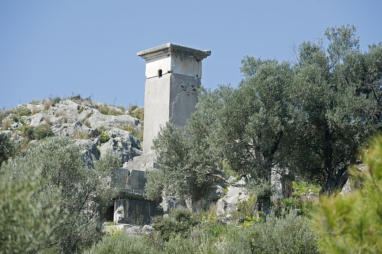
Xanthos, the political capital, stands as a testament to Lycian resilience. Its history is one of fierce independence and tragic defiance. In 540 BCE, according to the Greek historian Herodotus, faced with siege by the Persian general Harpagus, the Xanthian men gathered their women, children, slaves, and treasures into the acropolis and set it ablaze. They then charged out to fight to the death. The city was repopulated and flourished again, leaving behind some of the most spectacular funerary architecture in the ancient world. The towering Pillar Tomb and the exquisite Harpy Tomb (reliefs now in the British Museum) showcase a fusion of Greek, Persian, and unique Lycian styles, with inscriptions in the still-partially-understood Lycian language.

Sunken city of Kekova - panoramio (7) | Tanya Dedyukhina (CC BY 3.0)
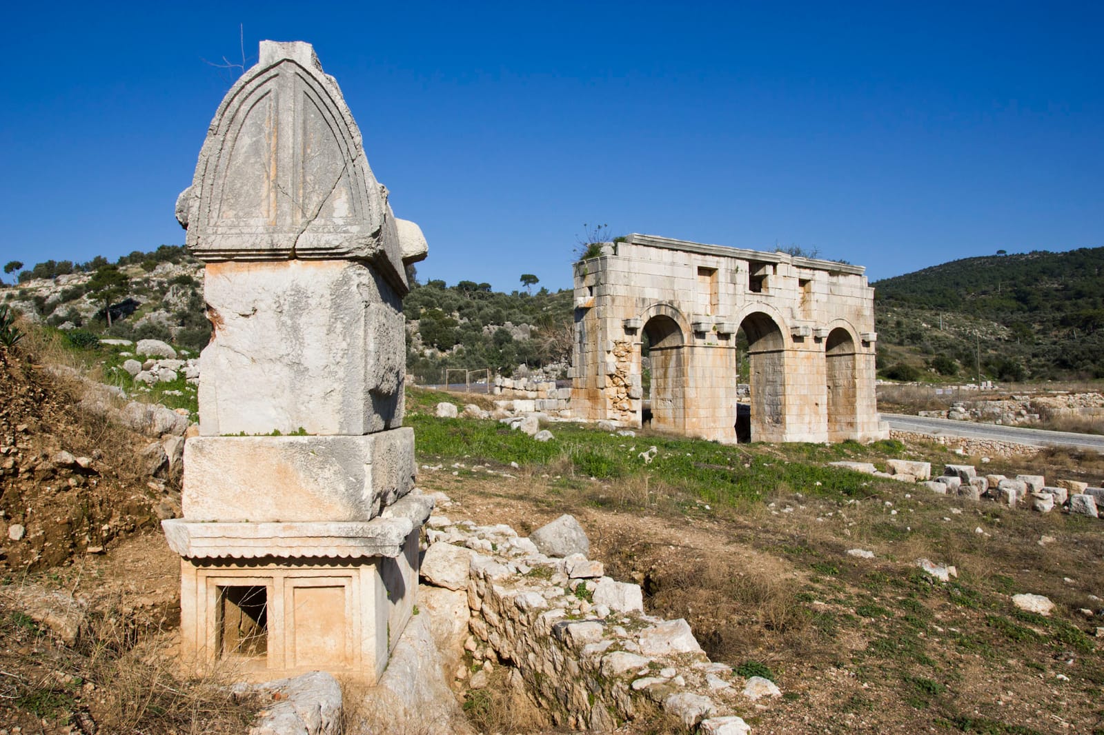
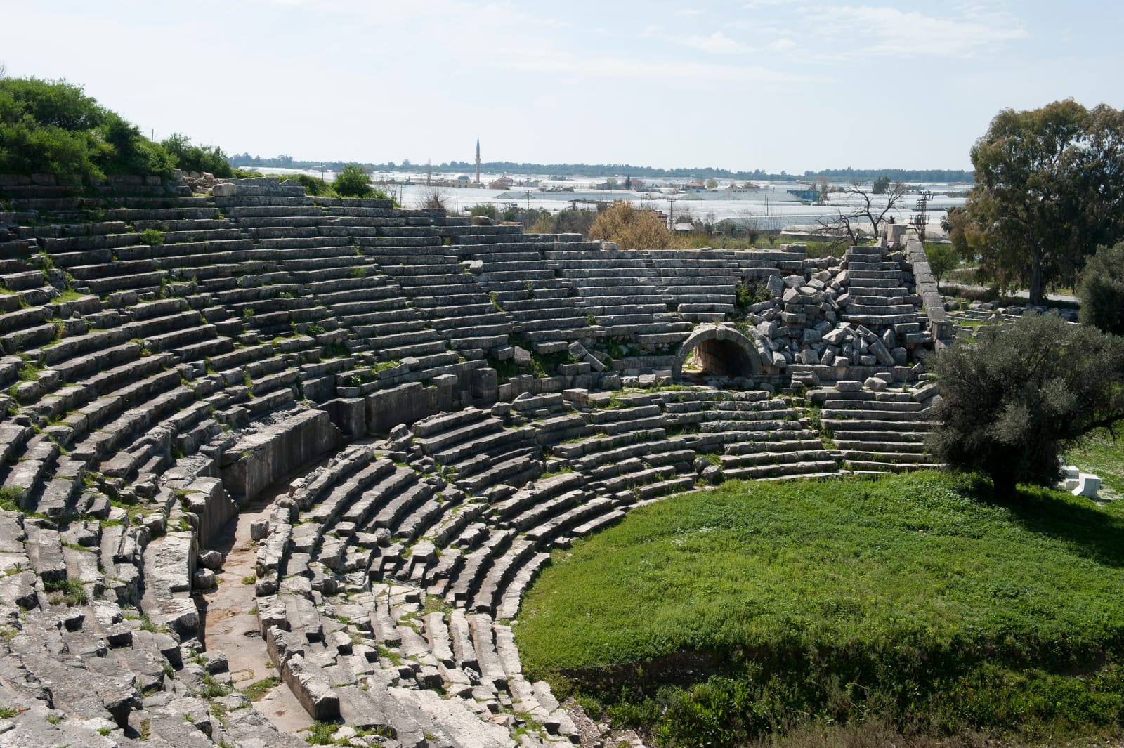
Just 10 kilometers south lay Patara, the primary maritime port of Xanthos and one of the most important harbors of the entire eastern Mediterranean. Renowned for its oracle of Apollo, rivaling that of Delphi, Patara was a hub of commerce and prophecy. Its immense granary built by Emperor Hadrian (117-138 CE) and its beautifully restored theater speak to its enduring importance into the Roman era. It was also the birthplace of St. Nicholas, the 4th-century bishop who would later morph into the figure of Santa Claus. The siltation of its harbor, a slow-motion environmental change, eventually led to its abandonment, a terrestrial echo of Kekova’s more dramatic submersion.
Between these two power centers sat the Letoon, the federal religious sanctuary of the Lycian League. Dedicated to the goddess Leto and her twin children, Apollo and Artemis, this sacred complex contained three temples side-by-side. A crucial discovery here was the "Trilingual Stele" dating to 358 BCE. Inscribed in Lycian, Greek, and Aramaic, this decree by the Persian satrap Pixodaros provided the Rosetta Stone for the Lycian language, allowing scholars to finally begin deciphering this unique tongue and understanding Lycian laws and customs. The Letoon underscores the cultural cohesion that bound the disparate Lycian cities, including coastal outposts like Dolichiste (Kekova).
Myra: The Metropolis of the Mountains and Sea

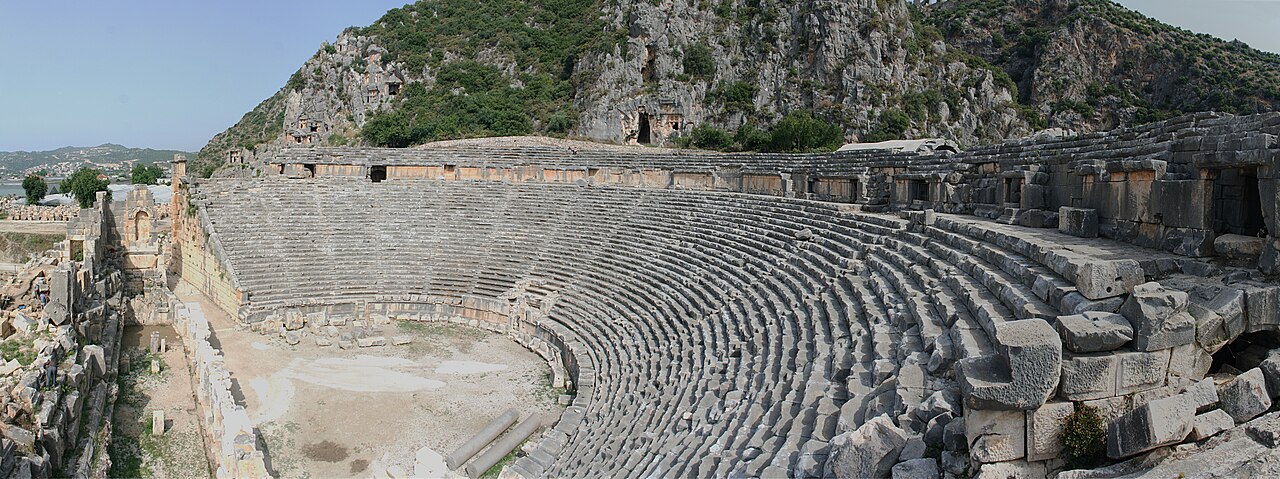
Myra Rock Tombs | Saffron Blaze (CC BY-SA 3.0)
Down the river from the highlands of Xanthos lies Myra, another giant of the Lycian League. Famous in the modern era for its Church of St. Nicholas, Myra’s ancient credentials are staggering. Its rock-cut tomb facades, carved directly into the vertical cliffs of its theater, are the most dramatic examples of Lycian funerary art. These tombs, mimicking wooden house architecture with intricate reliefs, were the eternal homes of Myra’s elite.
But Myra’s connection to our story is also maritime. Its port was Andriake, located a few kilometers south. Andriake’s vast granary of Hadrian (built 129-130 CE), a 65-meter-long warehouse, highlights the scale of grain shipments flowing through Lycia to Rome. Myra and its port formed a critical node in the coastal trade network that linked the inland Lycian cities to the wider Mediterranean. Kekova, situated further along the coast, was part of this same vibrant, interconnected system — a smaller port likely engaged in local trade, fishing, and perhaps serving the estates on the mainland.
The Great Cataclysm: Earthquake and Inundation
The idyllic ruins of Kekova did not sink due to a slow rise in sea levels. The event was sudden, violent, and transformative. In the 2nd century CE, likely during the reign of Emperor Marcus Aurelius, a massive earthquake struck the Lycian coast. This was not an isolated event; the entire region is seismically active, sitting on the complex boundary between the Anatolian and Aegean plates.
This particular quake was catastrophic. It caused a phenomenon known as co-seismic subsidence**, where a block of the Earth’s crust abruptly drops. The land upon which the western part of Dolichiste was built fell by several meters, and the relentless Mediterranean poured in. Houses, streets, workshops, and tombs were instantly flooded. The eastern part of the settlement, on higher ground, remained above water and life continued, but the city’s heart and its harbor were lost to the sea.
Archaeological evidence from the site confirms this timeline. Pottery and coin finds in the submerged structures date no later than the 2nd century CE. The visible ruins show clear signs of seismic destruction — walls collapsed in unison, blocks displaced laterally — before being stabilized by the sea’s embrace. This event froze a moment in time, creating an underwater museum of Roman-era Lycian daily life.
Reading the Sunken City: An Archaeological Palette
Today, Kekova is a protected area, and diving on the main site is prohibited to preserve its fragile remains. However, snorkeling and boating offer breathtaking views. The archaeological palette is laid out with stunning clarity:
- The Submerged Urban Fabric: Parallel to the shore of Kekova Island, the outlines of buildings are perfectly visible. You can trace the foundations of multi-room houses, some with doorways and window frames still intact. A wide, stepped street slants down into the water, a ghostly pathway leading nowhere.
- The Necropolis Preserved: Along the shoreline of the mainland near the modern village of Kaleköy (ancient Simena), a series of Lycian sarcophagi stand half-submerged. These distinctive "house-tombs" with gabled lids, once resting in a dignified necropolis, now rise from the shallows, their bases encrusted with sea urchins and algae. They are poignant sentinels of the cataclysm.
- The Apse and the Mosaic: One of the most striking features is the remains of a basilica, a later addition from the Byzantine period (5th-6th century CE), proving the site remained inhabited. Its semi-circular apse is clearly defined underwater. Nearby, patches of a floor mosaic with geometric patterns can be glimpsed through the sand and seagrass, a splash of color and artistry on the seabed.
- Terrestrial Simena: Above the waterline, on the dramatic outcrop at Kaleköy, the story continues. A crude but charming Lycian rock-cut tomb is embedded in the steps leading up to a small Byzantine castle, itself built with reused ancient masonry. Within the castle walls lies one of the **smallest theaters in Anatolia, with just a few rows of seats overlooking the sunken city — a perfect vantage point for contemplation.
Kekova in Context: A Maritime Crossroads
Kekova was never a major capital like Xanthos or a grand port like Patara. Its importance lies in its typicality. It represents the network of smaller coastal communities that formed the lifeblood of Lycia. It was a place of local industry — likely pottery production and purple dye from murex snails have been suggested. Its sheltered sound provided safe anchorage along a treacherous coast.
Its submersion, therefore, preserves not the story of kings and empires, but of merchants, fishermen, potters, and homeowners. The scatter of amphorae on the seabed speaks of trade. The layout of the houses speaks of domestic life. The proximity of the necropolis to the living city reflects the Lycian belief in the continuity between life and death, a belief now underscored by the city’s own state of suspended animation between land and sea.
Preservation and Perception: A Fragile Legacy
The very elements that preserved Kekova for 1,800 years now threaten it. The clear, salty water that allows us to see the ruins also hosts organisms that slowly erode the stone. Bio-erosion from algae, sponges, and mollusks is a constant process. Furthermore, its beauty is its curse. Unregulated tourism, anchoring, and even the gentle touch of curious snorkelers can cause cumulative damage.
Turkish authorities, recognizing its unique value, have designated the area a Specially Protected Area** since 1990. Access to the sunken city itself is strictly controlled. This delicate balance between accessibility and preservation is the great challenge for 21st-century heritage management. Kekova is not just a Turkish treasure; it is part of humanity’s shared history, a chapter in the story of how civilizations interact with — and ultimately succumb to — the powerful forces of the natural world.
Legacy
Standing on the ramparts of Simena castle, looking out over Kekova Sound, one engages in a profound chronological dialogue. In the foreground, the sunken city whispers of a seismic moment in the 2nd century. Beyond, the islands and sea lanes speak of the Lycian sailors who navigated them for a thousand years before that. And inland, the psychic presence of Xanthos, Patara, the Letoon, and Myra completes the picture.
Kekova’s sunken city is more than a picturesque ruin. It is a direct physical link to the Lycian world. It connects the federal politics of Xanthos, the sacred rites of the Letoon, the commercial pulse of Patara and Myra, and the daily rhythms of ordinary people. It is a monument not to death, but to transformation. The Lycians, who so revered their dead with monumental tombs, could never have imagined that an entire city would become a tomb — and a reliquary — for its own way of life, preserved in the silent, blue museum of the Mediterranean. In its quiet, submerged streets, we find a powerful reminder: history is not always buried beneath the earth. Sometimes, it waits for us, shimmering just beneath the surface of the waves.